Organizing a Mapping Exercise in Your Community
The following guidelines provide a jumping off point for organizing and facilitating a mapping exercise.
Gather Information
Begin by gathering the following types of information from the comprehensive plan or elsewhere:
- Current use patterns of developed land and identification of land available for development
- Growth projections for the community (from federal Census data or state or regional agency projections)
- Current capacities of community service providers such as police and fire departments, schools, hospitals and utilities.
Prepare Materials
Maps
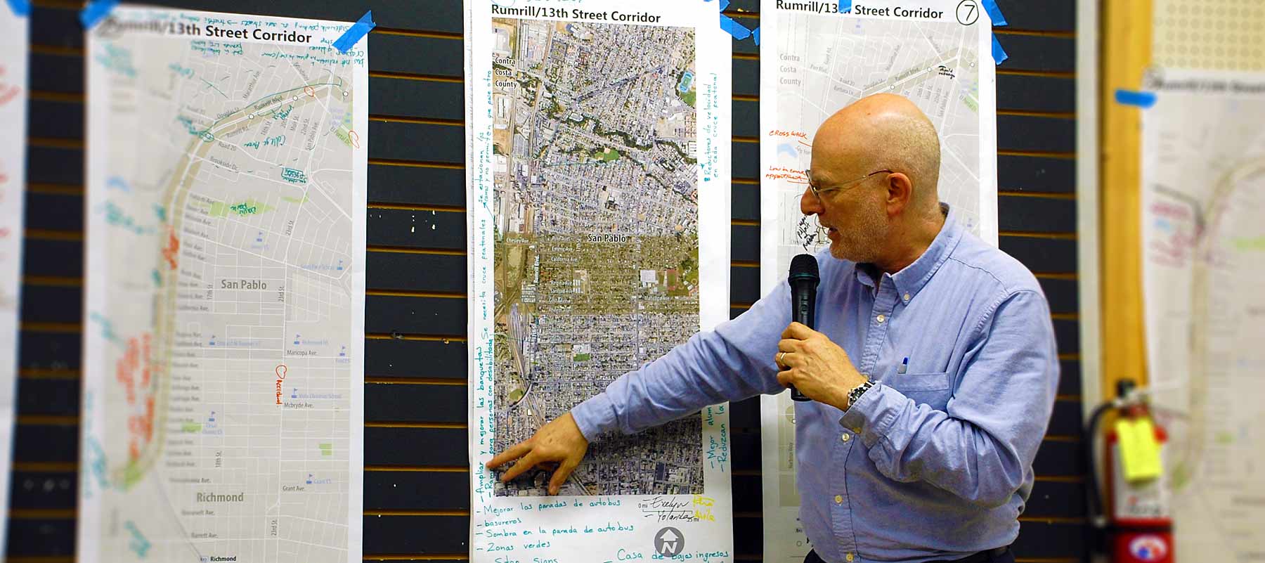
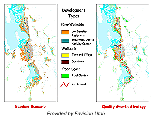
Regional maps, generally taken from the community’s comprehensive plan should be printed at a scale conducive to group work around a table. Current development patterns should be color coded on the maps to identify land as residential, commercial, industrial, public, etc. Likewise, sensitive areas such as wetlands, steep slopes and wildlife corridors should be identified. With developed and restricted lands clearly marked, the remaining, developable lands become easy to identify.
In some cases, planning staff may decide to include supplemental overlays on trace paper in order to represent planned changes to infrastructure such as future roadways, schools, parks, etc.
Clear overlays, to which participants may adhere development icons and draw with grease pencils, may also be included.
Development Chips
“Development chips” will be used by participants to physically show where and how they envision future development to occur.
 Create chips that represent a cluster of new residents. Each chip will be scaled to represent a given amount of land area on the map. Each chip will also represent a predetermined number of new residents at current or projected density levels. Participants place chips on the map to show where they would place new development. Higher densities can be represented by stacking the chips on top of each other. Participants are given a number of chips that represent all projected new residents. The participants must decide how to place all of the chips on the map.
Materials for Group Tables
- Permanent Markers (various colors)
- Grease Markers (various colors)
- Tape
- Scissors
- Name Tags
- Note Pads
- Pencils
- Reference Data
- Glue Sticks
Workshop Implementation
Choosing a Facility
Chose a facility with several large tables for group work. This facility may be a community center, meeting hall, or public library.
Typical Session Agenda
The following outline is meant to provide a general framework for a land-use workshop agenda. Each community will adapt this framework to its own unique situation and objectives.
A. Introduction
A representative of regional government generally gives an introduction. This is an opportunity to welcome the participants and provide a general sense of the goals and objectives for the exercise.
B. Presentation of The Challenge
Here, the growth related problems facing the community are presented to the participants. Citing Census or population projection data, a planning challenge is identified. This challenge should be clear and concise and may look somewhat like the following:
Our (neighborhood, city, county, etc.) will receive (#) new residents by (Year). Your job is to decide where and how to provide (#) new units of housing while maintaining a high quality of life for all members of the community.
To clarify what is meant by “maintaining a high quality of life”, the following principles of Smart Growth can be presented:
- Reducing sprawl through infill instead of greenfield development
- Using through street designs rather than cul-de-sacs
- Using narrow streets and other traffic calming measures
- Demanding high standards of energy conservation
- Designing with minimal setbacks and hidden garages
- Employing mixed-use development
- Planning for transit systems
Smart growth principles such as the Local Government Commission’s Ahwahnee Principles, may be appropriate to use here.
Brief videos and/or slide shows may be shown at this point in order to present these concepts visually.
C. Describe Group Process / Lay Ground Rules
Each group will be assigned a facilitator, generally a planner, commissioner, or other person familiar with planning issues in the community. The groups will be asked to choose one of their members to act as note taker and one or two members to present findings.
All participants should be asked to adhere to the following norms:
- Speak one at a time
- Make sure that all participant’s opinions are heard
- Respect the opinions of others
- Avoid spending a disproportionate amount of time on a single issue
- Do not treat the session as an opportunity to preach or editorialize
- Outcomes should be made for the good of the community, not based on personal interests
D. Group Work
Groups are given a predetermined amount of time to work through the challenge, develop plans, and represent those plans on the map using the development chips and/or pencils and markers. The group can use the overlays to record their ideas. Each group should list their names on their map.
Step 1: Where to Grow?
Each group should determine where to grow. The areas that the group thinks the community should grow will be marked on the overlay using permanent markers. These areas should be color-coded to distinguish between different types of development. For example Infill = Green, Greenfields = Blue, and Redevelopment = Orange.
As part of this step, participants can be asked to consider what forms of transportation (car, bike, walk, transit, etc.) are best suited to provide accessibility to the areas where growth is prescribed.
 |
Step 2: How to Grow?
Each group should place their development chips on the overlay to show the density and distribution that they prescribe. Once all of the chips have been placed, the team will glue them to the overlay using glue sticks.
Facilitators work throughout the group work portion of the workshop to:
- Answer questions and clear up misconceptions
- Make sure that all voices are heard
- Give direction
- Ensure that participants are aware of the time remaining
E. Group Presentations
Once the group work period has ended, each group’s spokesperson should present their proposals to the entire workshop. Presenters should use their group’s completed map to explain their plan and why and how the arrived at their conclusions.
Depending on time limitations, facilitators may choose to have a question-and-answer period and/or limited discussion session.
During this time, one of the facilitators should be responsible for summarizing the proposals and looking for trends in approach, points on which the different groups took a common approach, etc.
F. Closure
During this final period of the session, a member of the facilitation team should recap the findings of the various groups and identify common threads of consensus and disagreement among the participants.
Before ending, the planning staff should explain to participants how and when their ideas will be used.
Final Report
The findings of the mapping exercise should be tabulated and presented in a user-friendly report. This report should be presented at a public meeting.
Case Studies in Participatory Land-Use Mapping
The following table gives a comparative overview of cities or regions that have done a participatory mapping exercise.
| Wasatch, Utah | Olympia, WA | Dade County, FL | |
|---|---|---|---|
| Geographic Area covered | The greater Wasatch Area, encompassing 98 Cities within 10 Counties | 4 Olympia neighborhoods (facilitated through 4 separate workshops) | The Southern Dade County area |
| Number of Participants Per Workshop | 200 people, divided in to groups of 7-10 | 25-50 participants per workshop, divided in groups of <10. | ~100 people divided into groups of 5-7. |
| The Challenge | To house 1 million additional residents by 2020 | To house 9,300 new residents in 4,200 new residential units by 2015 | To house 26, 00 new residents and create 100-acres of new commercial and 100-acres of new industrial zones. |
| Map Scale | N/A | 1” = 500’ | 1” = 300’ |
Links
Blueprint Transportation and Land Use Study Sacramento Area Council of Governments (SACOG)
http://www.sacregionblueprint.org/sacregionblueprint/
Envision Utah
http://www.envisionutah.org/
City of Olympia Community Planning and Development
http://olympiawa.gov/city-government/departments/community-planning-and-development.aspx