Site icon Local Government Commission

Geographic Information Systems: A Tool For Improving Community Livability

GIS software can help policy makers and stakeholders to make more informed and more effective decisions by relating data with place. GIS can take an overwhelming amount of information – tabular, spatial, or graphic – and display it in a way that makes it meaningful to local government staff, policy makers and the public. By displaying information in layers – each layer with a particular issue – it is easier to understand how issues interrelate. This fact sheet (PDF, 720 KB) contains examples of how communities have used GIS to improve the livability of their communities.

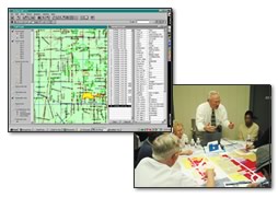
Geographic Information Systems: A Tool For Improving Community Livability (PDF, 720 KB)